-
Get It
$19.99
$19.99Civil 3D Essentials Book and Practice Files
Tutorial: Creating Civil 3D Point Manual
Introduction to Creating Civil 3D Point Manual
Why Create a Civil 3D Point Manually? Let's find out in this online training course and tutorial, a part of the Civil 3D essentials book and how-to manuals.
4.4 Creating points
We've seen how to import existing points collected from a land survey. However, we often need to create additional points. The reason may be for design purposes, incomplete field survey data that needs to be enhanced in the office, construction stakeout, or other motives.
Whatever the case may be, Civil 3D has a tool called the Point Creation Toolbar that allows us to create the points needed for different circumstances.
Let's explore a few cases where we need to create points.
- Continue working with the same SURVEYING.DWG file.
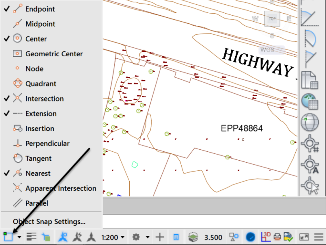
- Make sure osnapis activated (It will be blue when it's active and dark when disabled):

- Right-click on Object Snap to activate the following modes: Endpoint, Center, Intersection.
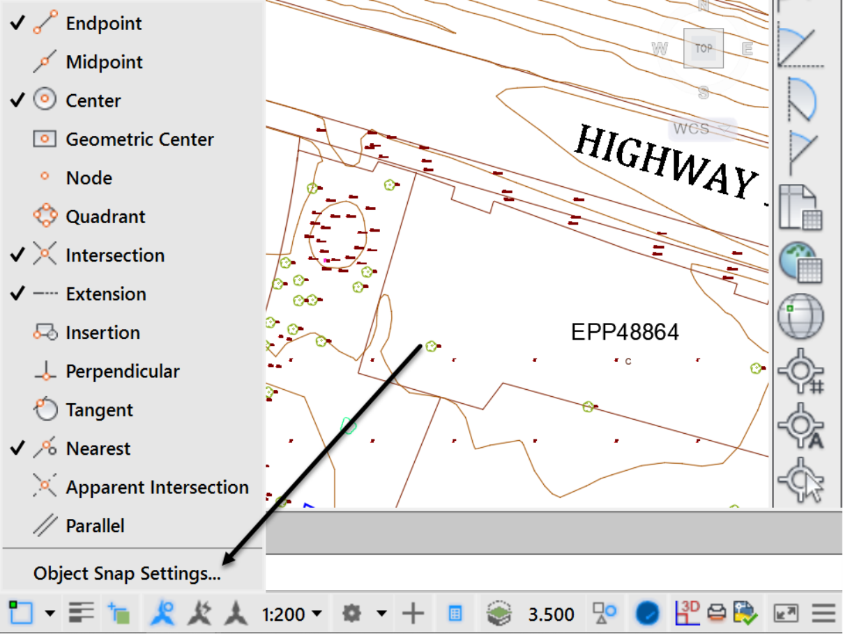
- Alternatively, you can select Object Snap Settings and select the Snap modes of your choice.
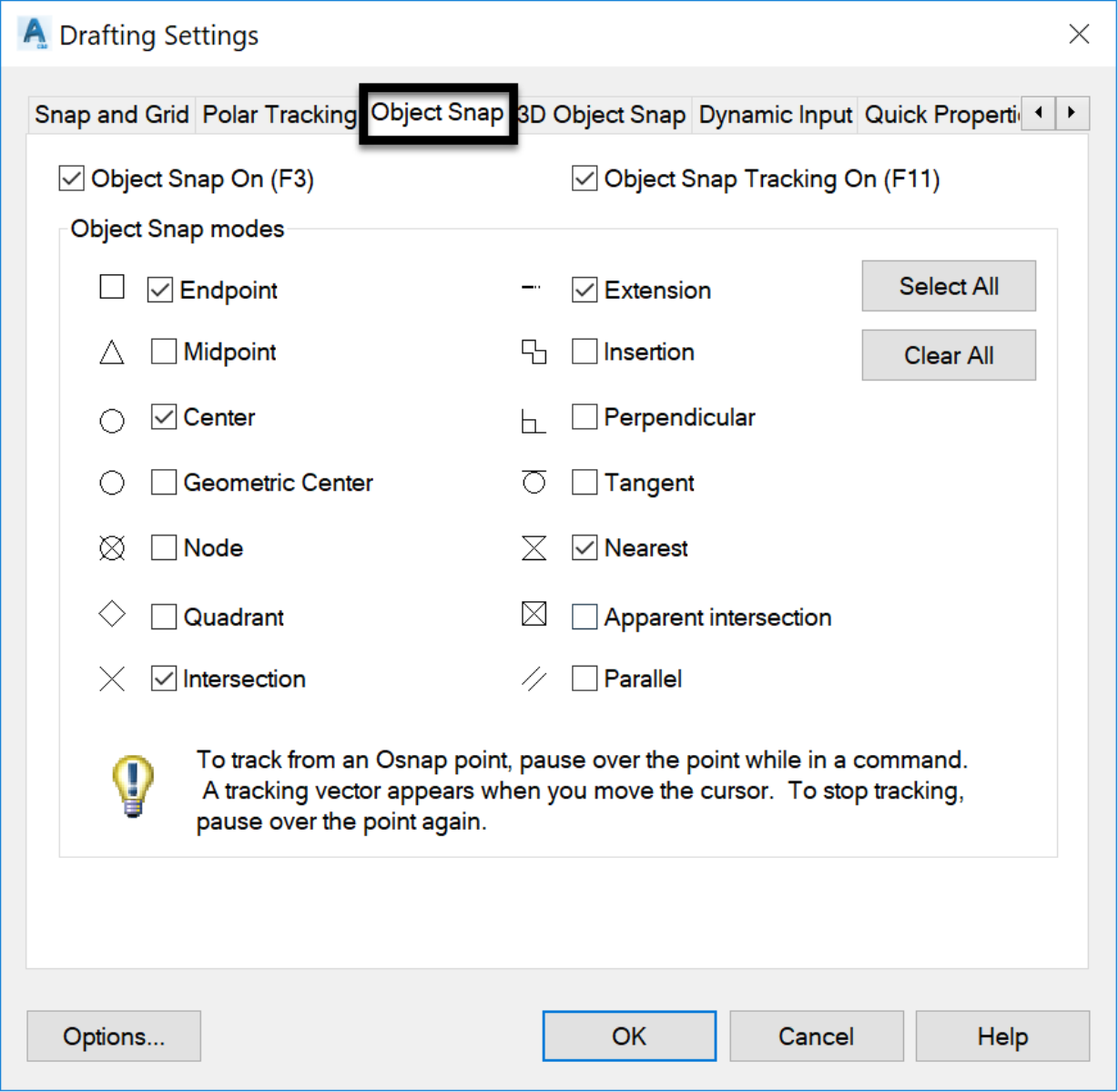
- Then, from the Object Snap tab, select the modes to activate.
- Click

Topic: Civil 3D Manual Point | Training: Civil 3D Essentials | Software: AutoDesk Civil 3D
Civil 3D course OFFER
Refer a friend and both of you get access to our Civil 3D Courses at a discounted price.
Related Civil 3D Course and Books

