-
Get It
$19.99
$19.99Civil 3D Essentials Book and Practice Files
Tutorial: Civil 3D Points from a Surface
Introduction to creating Civil 3D Points from a Surface
How to create Civil 3D Points from a Surface? Let's find out in this online training course and tutorial, a part of the Civil 3D essentials book and how-to manuals.
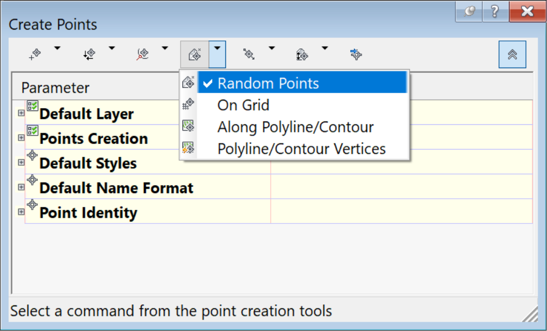
4.6 Creating points from a surface
- Each project needs to be integrated into an existing environment. For instance, we need to tie proposed utilities to the existing infrastructure; we need to daylight existing proposed grades to the existing ground on the edges of the site. In this case, there are lots and roads already built in a previous phase. So, we must maintain the elevations along these pre-existing lots and roads. The best way to do it is to create points with elevations matching the existing ground as surveyed. To create points from a surface, use the point created by the surface command:
- Click on the back of lot corners along Tulips Crescent and Jasmine Blvd.
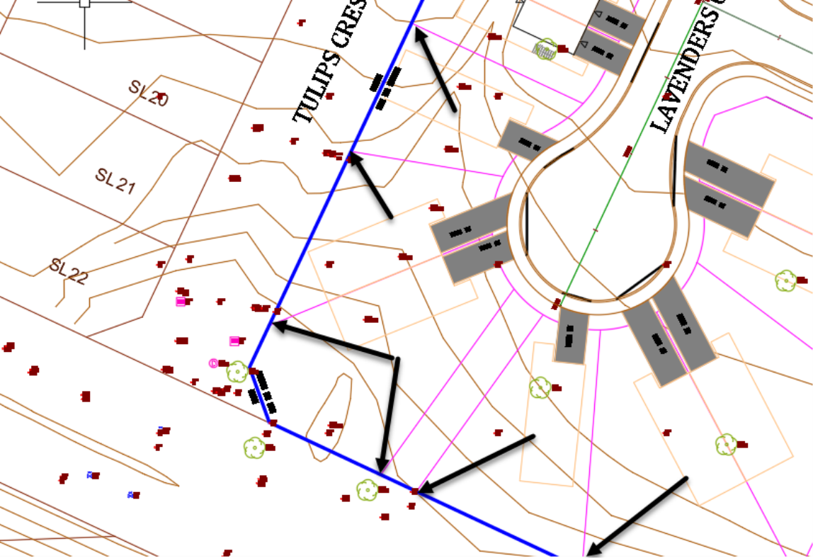
- When prompted for the description of the point, type DG-EG at the command line. These are design points with Existing Ground (EG) elevations.
- Continue to press Enter at the command line to accept the description DG-EG for the next points. If you make a mistake, you can always return and restart the point creation command.
Topic: Civil 3D Points from a Surface | Training: Civil 3D Essentials | Software: AutoDesk Civil 3D
Civil 3D course OFFER
Refer a friend and both of you get access to our Civil 3D Courses at a discounted price.
Related Civil 3D Course and Books

