Civil 3D Survey: Importing Fieldbooks
Field to Finish Surveying Fieldbooks
Product: Autodesk Civil 3D | Subject: Surveying with Civil 3D
In this exercise, we will learn about Civil 3D Survey
Importing the Survey data
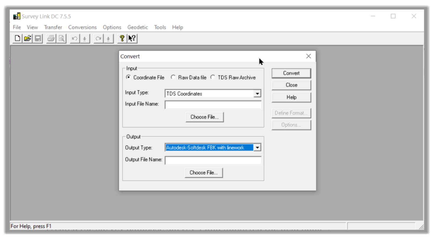
In this exercise, we will import a survey file in a Fieldbook format. As a reminder, a Fieldbook is not a custom file format. It's a proprietary file format created by Softdesk, which has been acquired by Autodesk, along with its land development line of design software.
Fieldbooks contain all raw original survey information, including observations, figure definitions, setups, control points, etc.
We can create a Fieldbook file by exporting it directly from an instrument or converting other raw survey data to a Fieldbook format using the survey data collection link inside Civil 3D.
- First, open the practice file Traverse.dwg
- Using all the steps previously described, import the survey file F2F Traverse.fbk located in the Imports folder. During the import process.
- Create a New Database called FV Traverse
- On the Specify Data Source page, make sure to select a Fieldbook file format
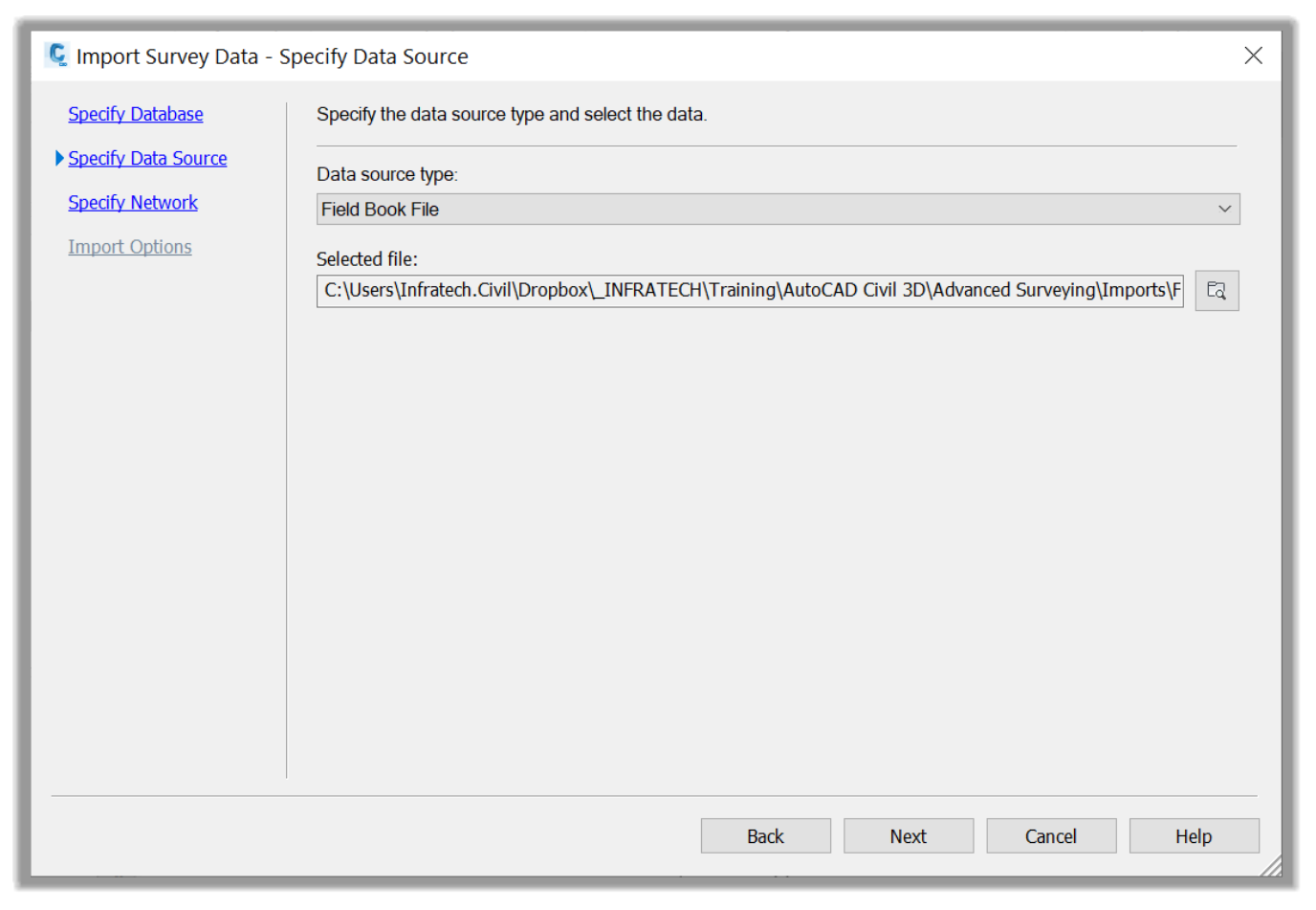
- Create a network names FV Traverse Network
- On the import options page, activate the Show Interactive graphics options, the Insert figure object, the Insert survey points option, and keep all other parameters to their defaults. We have not created a matching figure prefix database to stylize all the lines, but the default line styles will be enough for this exercise.

- Next, click on Finish to import the Fieldbook file.
- The network is now imported, and the points and lineworks are automatically created for us.
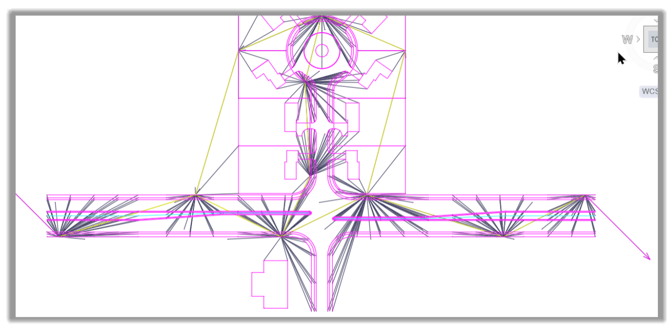
- Now let's proceed to the analysis of the survey data.
Full Course and Free Book
-

Civil 3D Essentials Book and Practice Files
Course4.9 average rating (69 reviews)This mini-course offers a downloadable manual of Civil 3D. The eBook covers the features needed to successfully design most civil engineering projects, from field data collection to final design and layout.
Purchase$19.99
-

Advanced Civil 3D: Surveying and Construction
Course5.0 average rating (4 reviews)In this Online Survey and Construction Civil 3D training course, participants will learn and apply the tools offered by Civil 3D, to perform advanced survey and construction tasks.
$99 / year