Civil 3D Survey linework stakeout
Field to Finish linework stakeout
Product: Autodesk Civil 3D | Subject: Surveying with Civil 3D
In this exercise, we will learn how to stake out a Civil 3D Survey linework.
6.5 Staking a linework
Another option for staking is through the use of lines. These lines can be simple 2D or 3D lines exported from a CAD software.
In this example, we will use the same controller app we have used through this course.
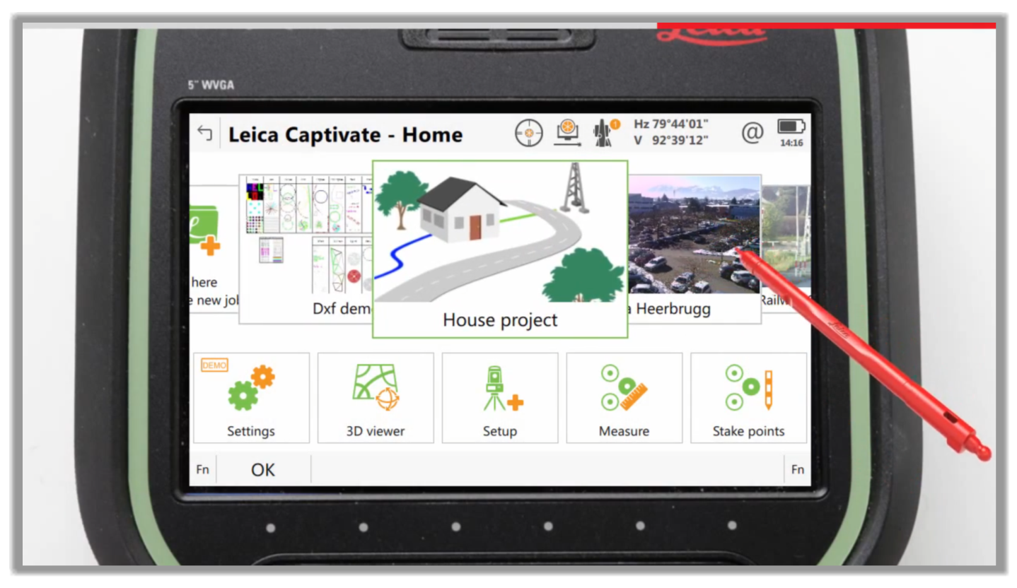
Let's see an example of how to stake a house project where we have several different types of lines, from a road, a building footprint, an utility service line, and a pipeline.
As we mentioned, the CAD linework to stakeout can be a line between 2 points, a polyline with multiple points and segments, made up of tangents and arcs.
We should also mention that in addition to importing a CAD file, lines can be created in most survey controllers because they are so basic.
Let's see how to stakeout a linework.
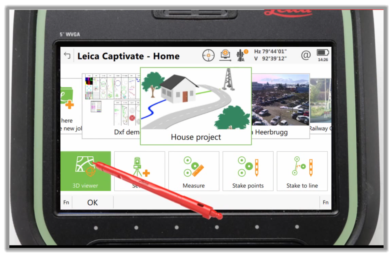
- First, let's access the Stake to line module of the controller app.
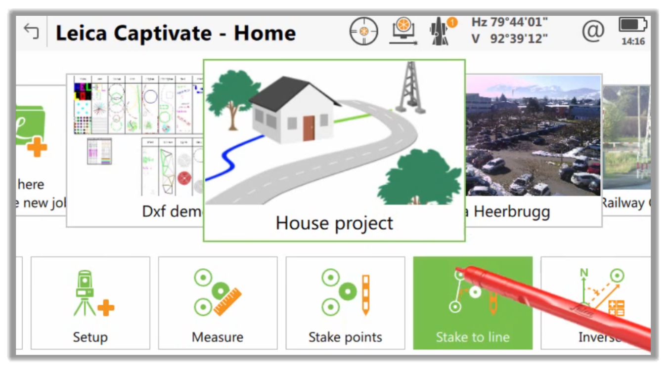
- Depending on your controller, you will have various ways to access the Stake a linework module. This app can also access the module through the 3D viewer within our active job.
- By tapping and holding on a line we're interested in, we are presented with the context menu.
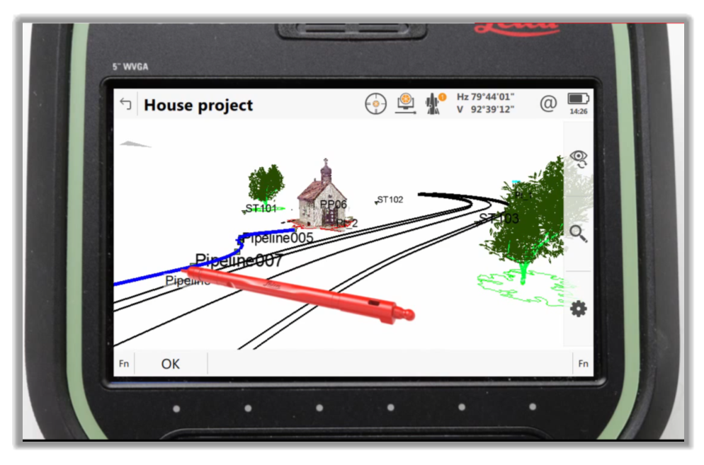
- We can then choose to stake or measure a line.
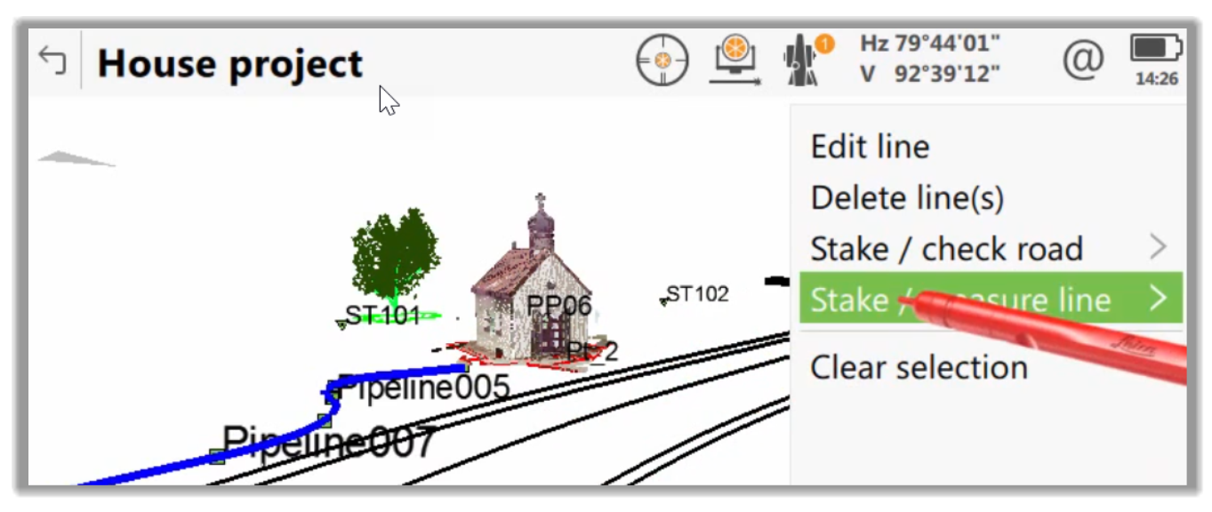
- Here, we can choose what we want to do.
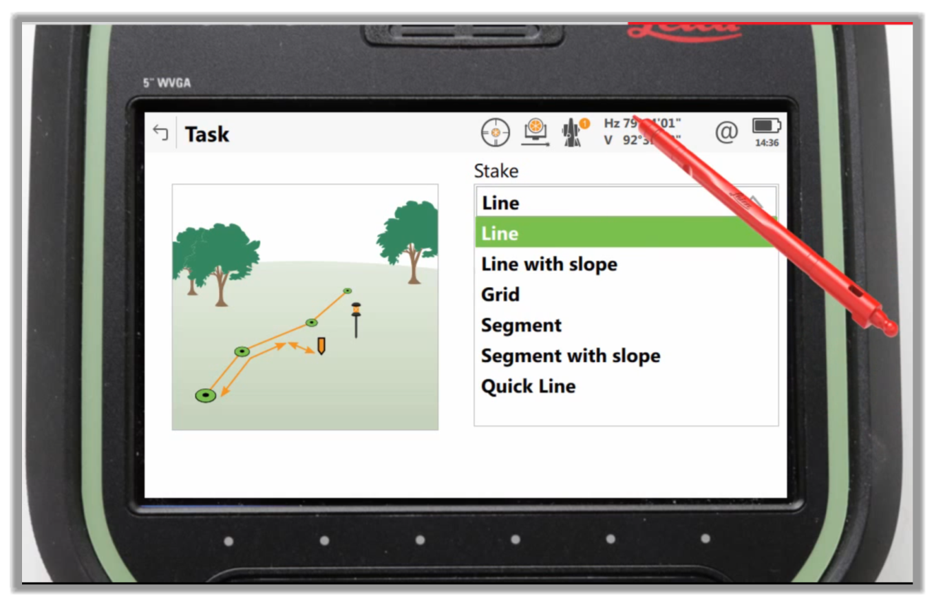
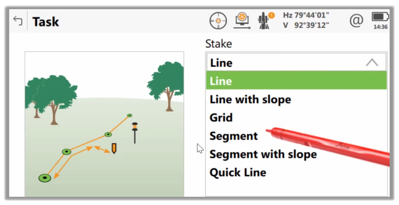
- Next, we can just follow our controller app's workflow to complete the task at hand, whether we would like to stake a Line, Line with Slope, Grid, Segment, Segment with Slope, Quick Line, or whatever option our controller has.
Full Course and Free Book
-

Civil 3D Essentials Book and Practice Files
Course4.9 average rating (69 reviews)This mini-course offers a downloadable manual of Civil 3D. The eBook covers the features needed to successfully design most civil engineering projects, from field data collection to final design and layout.
Purchase$19.99
-

Advanced Civil 3D: Surveying and Construction
Course5.0 average rating (4 reviews)In this Online Survey and Construction Civil 3D training course, participants will learn and apply the tools offered by Civil 3D, to perform advanced survey and construction tasks.
$99 / year