Civil 3D Survey Road stakeout
Field to Finish Staking a Road
Product: Autodesk Civil 3D | Subject: Surveying with Civil 3D
In this exercise, we will learn how to stakeout a Civil 3D Survey road.
6.2 Staking out a Road
- First, we need to switch to the Road Data module of the controller.
- In the module, we can perform stakeout activities such as staking out one of the lines that define the road model. In this case, we will stake out the centerline.
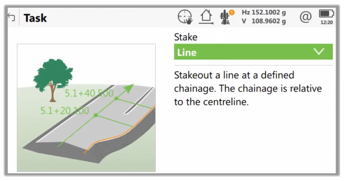
- It is possible to use any of the different views, such as a cross-section, plan view, or the stakeout view, and select the one that best suits each scenario.
- Once we are close enough and the arrows are displayed in green, we place the stake in the ground, and we store the point.
- The rest of the stakeout and different options available will depend on your equipment, but it is a typical field stakeout operation beyond the scope of this work.
Full Course and Free Book
-

Civil 3D Essentials Book and Practice Files
Course4.9 average rating (69 reviews)This mini-course offers a downloadable manual of Civil 3D. The eBook covers the features needed to successfully design most civil engineering projects, from field data collection to final design and layout.
Purchase$19.99
-

Advanced Civil 3D: Surveying and Construction
Course5.0 average rating (4 reviews)In this Online Survey and Construction Civil 3D training course, participants will learn and apply the tools offered by Civil 3D, to perform advanced survey and construction tasks.
$99 / year